Cairns · council area
Needs action
No Emergency Warnings or Watch and Act alerts right now.
Current items by layer
- Fire1No warnings
- Roads1No warnings+24 planned or other
- Power outages13 planned or otherNo warnings
- Other4No warnings
Some other sources for Queensland aren't on this page yet, so this list may be incomplete
Nothing current for Burn areas or Earthquakes.
Live flood data for Queensland isn't available here yet
Live weather data for Queensland isn't available here yet
Live water supply data for Queensland isn't available here yet
Live algal blooms data for Queensland isn't available here yet
Live dams data for Queensland isn't available here yet
Live sharksmart data for Queensland isn't available here yet
Roads 25
Level: All levels · Emergency Warning · Watch and Act · Advice
Stationary vehicleHazard — Smithfield Bypass — SmithfieldSmithfield · QLD ·
Event: Hazard Type: Stationary vehicle Road: Smithfield Bypass Location: Smithfield Description: 1km north of the Smithfield Bypass and Captain Cook Highway intersection. Direction: Northbound…
Updated 27 Oct, 9:38 pm AEST · -16.8381, 145.6976
Details OpenStreetMap Source (Department of Transport and Main Roads)
Scheduled roadworkRoadworks — Mulgrave Road — EarlvilleEarlville · QLD ·
Event: Roadworks Type: Planned roadworks Road: Mulgrave Road Location: Earlville Description: Near Ishmael Road Impact: Lane or lanes reduced Direction: Southbound Towards: Earlville Advice: Observe…
Updated 27 Oct, 5:38 pm AEST · -16.9412, 145.7411
Details OpenStreetMap Source (Department of Transport and Main Roads)
Scheduled roadworkRoadworks — Gillies Range Road — Lake Barrine / Little MulgraveLake Barrine / Little Mulgrave · QLD ·
Event: Roadworks Type: Planned roadworks Road: Gillies Range Road Location: Lake Barrine / Little Mulgrave Description: Multiple locations between Goldsborough and Lake Barrine. Impact: Lane or lanes…
Updated 27 Oct, 5:38 pm AEST · -17.1874, 145.6951
Details OpenStreetMap Source (Department of Transport and Main Roads)
Scheduled roadworkRoadworks — Captain Cook Highway — Palm Cove / WangettiPalm Cove / Wangetti · QLD ·
Event: Roadworks Type: Planned roadworks Road: Captain Cook Highway Location: Palm Cove / Wangetti Description: Buchans Point and Ellis Beach Impact: Lane or lanes reduced Direction: Both directions…
Updated 27 Oct, 5:38 pm AEST · -16.7247, 145.6448
Details OpenStreetMap Source (Department of Transport and Main Roads)
Scheduled roadworkRoadworks — Captain Cook Highway (Sheridan Street) — Cairns NorthCairns North · QLD ·
Event: Roadworks Type: Planned roadworks Road: Captain Cook Highway (Sheridan Street) Location: Cairns North Description: James street Impact: All lanes affected Direction: All directions Delays:…
Updated 27 Oct, 5:37 pm AEST · -16.9087, 145.7611
Details OpenStreetMap Source (Department of Transport and Main Roads)
Scheduled roadworkRoadworks — Bruce Highway — Babinda / Fishery FallsBabinda / Fishery Falls · QLD ·
Event: Roadworks Type: Planned roadworks Road: Bruce Highway Location: Babinda / Fishery Falls Description: Near Bellenden Ker Impact: Lane or lanes reduced Direction: Both directions Advice: Observe…
Updated 27 Oct, 5:37 pm AEST · -17.2603, 145.9214
Details OpenStreetMap Source (Department of Transport and Main Roads)
Scheduled roadworkRoadworks — Pine Creek Yarrabah Road — East Trinity / YarrabahEast Trinity / Yarrabah · QLD ·
Event: Roadworks Type: Planned roadworks Road: Pine Creek Yarrabah Road Location: East Trinity / Yarrabah Description: Near Brown Bay Impact: Lane or lanes reduced Direction: Both directions Advice:…
Updated 27 Oct, 5:37 pm AEST · -16.8861, 145.8376
Details OpenStreetMap Source (Department of Transport and Main Roads)
Scheduled roadworkRoadworks — Captain Cook Highway — Cairns NorthCairns North · QLD ·
Event: Roadworks Type: Planned roadworks Road: Captain Cook Highway Location: Cairns North Description: Between Lily Street and Arthur Street Impact: All lanes affected Direction: Northbound Towards:…
Updated 27 Oct, 5:37 pm AEST · -16.9037, 145.7578
Details OpenStreetMap Source (Department of Transport and Main Roads)
Scheduled roadworkRoadworks — Cairns Western Arterial Road (Brinsmead Road) — BrinsmeadBrinsmead · QLD ·
Event: Roadworks Type: Planned roadworks Road: Cairns Western Arterial Road (Brinsmead Road) Location: Brinsmead Description: Between Brinsmead and Loridan Drive. Impact: Lane or lanes reduced…
Updated 27 Oct, 5:37 pm AEST · -16.9013, 145.7091
Details OpenStreetMap Source (Department of Transport and Main Roads)
Scheduled roadworkRoadworks — Bruce Highway — GordonvaleGordonvale · QLD ·
Event: Roadworks Type: Planned roadworks Road: Bruce Highway Location: Gordonvale Description: Near Maitland Road Impact: Lane or lanes reduced Direction: Southbound Towards: Gordonvale Advice:…
Updated 27 Oct, 5:37 pm AEST · -17.0536, 145.7685
Details OpenStreetMap Source (Department of Transport and Main Roads)
Scheduled roadworkRoadworks — Stratford Connection Road (Aeroglen Drive) — StratfordStratford · QLD ·
Event: Roadworks Type: Planned roadworks Road: Stratford Connection Road (Aeroglen Drive) Location: Stratford Description: Aeroglen Drive Impact: Lane or lanes reduced Direction: Both directions…
Updated 27 Oct, 5:37 pm AEST · -16.8773, 145.7424
Details OpenStreetMap Source (Department of Transport and Main Roads)
Scheduled roadworkRoadworks — Captain Cook Highway — Aeroglen / StratfordAeroglen / Stratford · QLD ·
Event: Roadworks Type: Planned roadworks Road: Captain Cook Highway Location: Aeroglen / Stratford Description: Between Arnold Street and Airport Avenue Impact: Lane or lanes reduced Direction: Both…
Updated 27 Oct, 5:37 pm AEST · -16.8844, 145.7471
Details OpenStreetMap Source (Department of Transport and Main Roads)
Scheduled roadworkRoadworks — Bruce Highway — Bentley Park / EdmontonBentley Park / Edmonton · QLD ·
Event: Roadworks Type: Planned roadworks Road: Bruce Highway Location: Bentley Park / Edmonton Description: Mill Rd to Bana Gindarja Bridge Impact: Lane or lanes reduced Direction: Both directions…
Updated 27 Oct, 5:37 pm AEST · -17.0158, 145.7442
Details OpenStreetMap Source (Department of Transport and Main Roads)
Scheduled roadworkRoadworks — Cairns Western Arterial Road (Kamerunga Road) — CaravonicaCaravonica · QLD ·
Event: Roadworks Type: Planned roadworks Road: Cairns Western Arterial Road (Kamerunga Road) Location: Caravonica Description: Near Botanica Drive Impact: All lanes affected Direction: Both…
Updated 27 Oct, 5:37 pm AEST · -16.8561, 145.6952
Details OpenStreetMap Source (Department of Transport and Main Roads)
Scheduled roadworkRoadworks — Cairns Western Arterial Road — CaravonicaCaravonica · QLD ·
Event: Roadworks Type: Planned roadworks Road: Cairns Western Arterial Road Location: Caravonica Description: From the Barron River Bridge to Caravonica State School Impact: All lanes affected…
Updated 27 Oct, 5:37 pm AEST · -16.8642, 145.6918
Details OpenStreetMap Source (Department of Transport and Main Roads)
Scheduled roadworkRoadworks — Bruce Highway — EdmontonEdmonton · QLD ·
Event: Roadworks Type: Planned roadworks Road: Bruce Highway Location: Edmonton Description: At Mill Road Impact: All lanes affected Direction: Both directions Delays: Delays expected (during active…
Updated 27 Oct, 5:37 pm AEST · -17.0194, 145.7450
Details OpenStreetMap Source (Department of Transport and Main Roads)
Scheduled roadworkRoadworks — Kennedy Highway — Macalister RangeMacalister Range · QLD ·
Event: Roadworks Type: Planned roadworks Road: Kennedy Highway Location: Macalister Range Description: Hairpin to Streets Creek Impact: Lane or lanes reduced Direction: Both directions Delays: Delays…
Updated 27 Oct, 5:37 pm AEST · -16.8425, 145.6731
Details OpenStreetMap Source (Department of Transport and Main Roads)
Scheduled roadworkRoadworks — Sheridan Street (Captain Cook Highway) — Cairns NorthCairns North · QLD ·
Event: Roadworks Type: Planned roadworks Road: Sheridan Street (Captain Cook Highway) Location: Cairns North Description: Between Grove St and James St Direction: Northbound Towards: Shell service…
Updated 27 Oct, 5:37 pm AEST · -16.9100, 145.7620
Details OpenStreetMap Source (Department of Transport and Main Roads)
Scheduled roadworkRoadworks — Anderson Street — ManooraManoora · QLD ·
Event: Roadworks Type: Planned roadworks Road: Anderson Street Location: Manoora Description: English St to Pease St. Impact: Lane or lanes reduced Direction: Both directions Delays: Delays expected…
Updated 27 Oct, 5:37 pm AEST · -16.9170, 145.7423
Details OpenStreetMap Source (Department of Transport and Main Roads)
Scheduled roadworkRoadworks — Anderson Street — ManundaManunda · QLD ·
Event: Roadworks Type: Planned roadworks Road: Anderson Street Location: Manunda Description: At McDonnell Street Impact: All lanes affected Direction: All directions Advice: Proceed with caution
Updated 27 Oct, 5:36 pm AEST · -16.9155, 145.7467
Details OpenStreetMap Source (Department of Transport and Main Roads)
Scheduled roadworkRoadworks — Port Connection Road — Parramatta ParkParramatta Park · QLD ·
Event: Roadworks Type: Planned roadworks Road: Port Connection Road Location: Parramatta Park Description: Between Martyn Street and Bunda Street Impact: Lane or lanes reduced Direction: Outbound…
Updated 27 Oct, 5:36 pm AEST · -16.9237, 145.7681
Details OpenStreetMap Source (Department of Transport and Main Roads)
Scheduled roadworkRoadworks — Bruce Highway — Aloomba / Fishery FallsAloomba / Fishery Falls · QLD ·
Event: Roadworks Type: Planned roadworks Road: Bruce Highway Location: Aloomba / Fishery Falls Description: North of Fishery Falls Impact: All lanes affected Direction: Both directions Advice:…
Updated 27 Oct, 4:01 pm AEST · -17.1514, 145.8586
Details OpenStreetMap Source (Department of Transport and Main Roads)
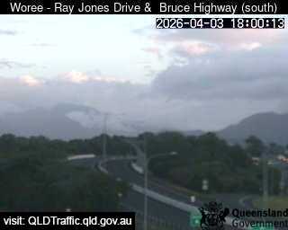
Traffic cameraWoree - Bruce Highway & Rigg StreetQLD
Camera: Traffic camera location Direction: East Location: Woree View camera image
-16.9556, 145.7485
Details OpenStreetMap Source (State of Queensland (Department of Transport and Main Roads))
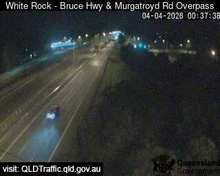
Traffic cameraWhite Rock - Bruce Highway & Murgatroyd Road Interchange - SouthQLD
Camera: Traffic camera location Direction: South Location: White Rock View camera image
-16.9769, 145.7437
Details OpenStreetMap Source (State of Queensland (Department of Transport and Main Roads))
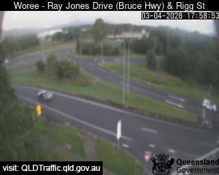
Traffic cameraWoree - Ray Jones Drive & Rigg StreetQLD
Camera: Traffic camera location Direction: South Location: Woree View camera image
-16.9538, 145.7474
Details OpenStreetMap Source (State of Queensland (Department of Transport and Main Roads))
Also in
Postcodes: 4870, 4868, 4879, 4869, 4878, 4865
Suburbs: Edmonton, Redlynch, Mount Sheridan (Qld), Bentley Park, Mooroobool, Gordonvale