Pialba · suburb
Needs action
No Emergency Warnings or Watch and Act alerts right now.
Show map of Pialbaabout 20 KB · loads only when opened▾ Hide map
Map preview · about 20 KB · © OpenStreetMap
Current items by layer
Nothing current for Fire, Burn areas or Earthquakes.
Live flood data for Queensland isn't available here yet
Live weather data for Queensland isn't available here yet
Live water supply data for Queensland isn't available here yet
Live algal blooms data for Queensland isn't available here yet
Live dams data for Queensland isn't available here yet
Live sharksmart data for Queensland isn't available here yet
Live other data for Queensland isn't available here yet
Roads 3
Level: All levels · Emergency Warning · Watch and Act · Advice
Scheduled roadworkRoadworks — Old Maryborough Road / Greenway Drive — PialbaPialba · QLD ·
Show map of Roadworks — Old Maryborough Road / Greenway Drive — Pialbaabout 20 KB · loads only when opened▾ Hide map
Map preview · about 20 KB · © OpenStreetMap
Event: Roadworks Type: Planned roadworks Road: Old Maryborough Road / Greenway Drive Location: Pialba Description: Hastings Street between Greenway Drive and Old Maryborough Road is closed to traffic…
Updated 24 Oct, 10:34 am AEST · -25.2803, 152.8252
Details OpenStreetMap Source (Fraser Coast Regional Council)
Scheduled roadworkRoadworks — Old Maryborough Road — PialbaPialba · QLD ·
Show map of Roadworks — Old Maryborough Road — Pialbaabout 20 KB · loads only when opened▾ Hide map
Map preview · about 20 KB · © OpenStreetMap
Event: Roadworks Type: Planned roadworks Road: Old Maryborough Road Location: Pialba Description: Westbound traffic on Old Maryborough Road is closed (local traffic only, including access to…
Updated 14 July, 9:54 am AEST · -25.2824, 152.8233
Details OpenStreetMap Source (Fraser Coast Regional Council)
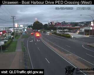
Traffic cameraUrraween - Boat Harbour Drive Pedestrian Crossing - WestQLD
Show map of Urraween - Boat Harbour Drive Pedestrian Crossing - Westabout 20 KB · loads only when opened▾ Hide map
Map preview · about 20 KB · © OpenStreetMap
Camera: Traffic camera location Direction: NorthWest Location: Urraween View camera image
-25.2880, 152.8371
Details OpenStreetMap Source (State of Queensland (Department of Transport and Main Roads))
Also in
Council areas: Fraser Coast
Postcodes: 4655