Riverview (Qld) · suburb
Needs action
No Emergency Warnings or Watch and Act alerts right now.
Show map of Riverview (Qld)about 20 KB · loads only when opened▾ Hide map
Map preview · about 20 KB · © OpenStreetMap
Current items by layer
Nothing current for Fire, Burn areas, Earthquakes or Power outages.
Live flood data for Queensland isn't available here yet
Live weather data for Queensland isn't available here yet
Live water supply data for Queensland isn't available here yet
Live algal blooms data for Queensland isn't available here yet
Live dams data for Queensland isn't available here yet
Live sharksmart data for Queensland isn't available here yet
Live other data for Queensland isn't available here yet
Roads 3
Level: All levels · Emergency Warning · Watch and Act · Advice
Scheduled roadworkRoadworks — Brisbane Road / Ipswich Motorway — Gailes / Redbank / RiverviewGailes / Redbank / Riverview · QLD ·
Show map of Roadworks — Brisbane Road / Ipswich Motorway — Gailes / Redbank / Riverviewabout 20 KB · loads only when opened▾ Hide map
Map preview · about 20 KB · © OpenStreetMap
Event: Roadworks Type: Planned roadworks Road: Brisbane Road / Ipswich Motorway Location: Gailes / Redbank / Riverview Description: Nightwork asphalt resurfacing on the Ipswich Motorway between the…
Updated 24 Oct, 6:45 am AEST · -27.6010, 152.8811
Details OpenStreetMap Source (Department of Transport and Main Roads)
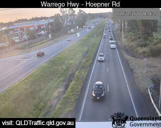
Traffic cameraBundamba - Warrego Highway Near Hoepner Road - WestQLD
Show map of Bundamba - Warrego Highway Near Hoepner Road - Westabout 20 KB · loads only when opened▾ Hide map
Map preview · about 20 KB · © OpenStreetMap
Camera: Traffic camera location Direction: West Location: Bundamba View camera image
-27.5880, 152.8230
Details OpenStreetMap Source (State of Queensland (Department of Transport and Main Roads))
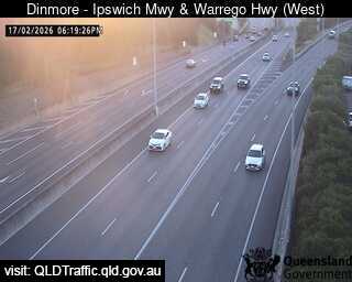
Traffic cameraDinmore - Ipswich Motorway & Warrego Highway - WestQLD
Show map of Dinmore - Ipswich Motorway & Warrego Highway - Westabout 20 KB · loads only when opened▾ Hide map
Map preview · about 20 KB · © OpenStreetMap
Camera: Traffic camera location Direction: West Location: Dinmore View camera image
-27.5957, 152.8415
Details OpenStreetMap Source (State of Queensland (Department of Transport and Main Roads))
Also in
Council areas: Ipswich
Postcodes: 4303