
Life-threatening emergency? Call Triple Zero (000). · SES flood and storm help: 132 500

Updated · Reload· Auto-refresh every 5 min· Theme: Auto · Light · Dark

Burnoff prescribed · Controlled

Burnoff Prescribed — Forest Range

Forest Range
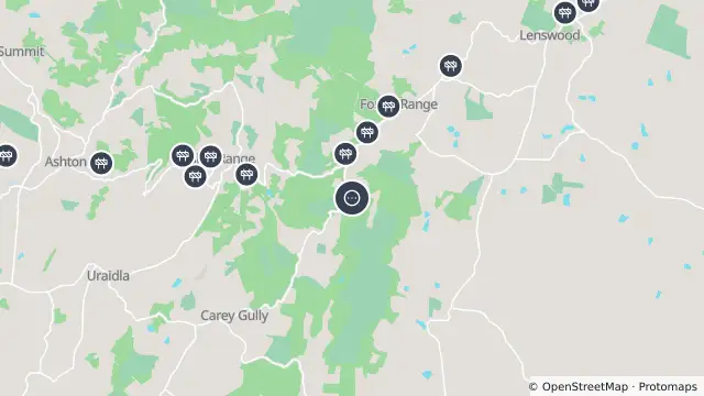
Map of Burnoff Prescribed — Forest Range and nearby items

Map preview · about 20 KB · © OpenStreetMap

Other · Roads

Published ·

Type: BURNOFF PRESCRIBED

Status: Controlled

Agency: CFS

Incident level: L1

Fire ban district: MOUNT LOFTY RANGES

Region: R1

Ground resources: 0

Aircraft: 0

Location
-34.9452, 138.7914
Source
Data © South Australian Country Fire Service. For current incidents and warnings refer to the CFS website. 

OpenStreetMap Open on the full interactive mapSouth Australia warnings

Nearby

  1. Scheduled roadwork634 m away

    Tree Pruning — Lobethal Road, Basket Range

    Details

  2. Scheduled roadwork634 m away

    Vms Trailer — Lobethal Road, Forest Range

    Details

  3. Scheduled roadwork634 m away

    Asphalt Works — Lobethal Road, Forest Range

    Details

  4. Scheduled roadwork634 m away

    Asphalt Works — Lobethal Road, Forest Range

    Details

  5. Scheduled roadwork956 m away

    Tree Pruning — Lobethal Road, Forest Range

    Details

  6. Scheduled roadwork956 m away

    Vms Trailer — Lobethal Road, Forest Range

    Details

  7. Scheduled roadwork956 m away

    Asphalt Works — Lobethal Road, Forest Range

    Details

  8. Scheduled roadwork956 m away

    Asphalt Works — Lobethal Road, Forest Range

    Details

  9. Scheduled roadwork1.4 km away

    Asphalt Works — Lobethal Road, Forest Range

    Details

  10. Scheduled roadwork1.4 km away

    Asphalt Works — Lobethal Road, Forest Range

    Details