Planned burn · Patrol
Fuel Reduction Burn — Rocherlea
Rocherlea
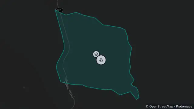
Map preview · about 20 KB · © OpenStreetMap
Published · Updated (3 hr ago)
Type: Fuel Reduction Burn
Status: Patrol
Address: BOUCHERS CREEK CONSERVATION AREA, ROCHERLEA, 7248
Incident number: 041585-16102026
Burnt area: 156.2 ha
Called: 16 Oct 2026, 6:50 am AEDT
Published: 16 Oct 2026, 6:51 am AEDT
Updated: 21 Oct 2026, 10:42 pm AEDT
Fuel Reduction Burn Rocherlea, Launceston 16th October 2026The Tasmania Fire Service conducted a fuel reduction burn on Friday 16th October at Rocherlea, Launceston, as part of the state-wide Fuel Reduction Program which is aimed at reducing the bushfire risk to help protect lives and communities.
The total area of this burn will be approximately 155 hectares. Smoke may persist some days afterward depending on wind conditions.
During burning operations public access to this area will be restricted. The public is asked to remain well out of the burn site while the burn is taking place and for the following days until safety checks have been made along tracks and trails. Please comply with directions from staff or any signs if you are in the area.
While the fire intensity will be low, it will generate flames, smoke and ash. People with medical conditions are advised to have a personal plan for avoiding smoke from the burn. Advice is
available from the Department of Health and Asthma Australia websites https://www.health.tas.gov.au/health-topics/environmental-health/air-quality and https://asthma.org.au/triggers/wood-heaters-woodfires-and-bushfires. Current air quality
information is also available via the Environment Protection Authority website https://epa.tas.gov.au/epa/air/monitoring-air-pollution/real-time-air-quality-data-for-tasmania
Further information about this burn is available by contacting the Tasmania Fire Service on phone 1800 000 699 or email BRU@fire.tas.gov.au. A map of planned burns is available on the TFS website at www.fire.tas.gov.au/Show?pageId=colWhatsBurningNow
- Location
- -41.3556, 147.1518
- Source
- © Tasmanian Government. Source: TasALERT (alert.tas.gov.au). · Attribution
OpenStreetMapOpen on the full interactive mapTasmania warnings
Nearby
Burn area0 m away