Scheduled roadwork
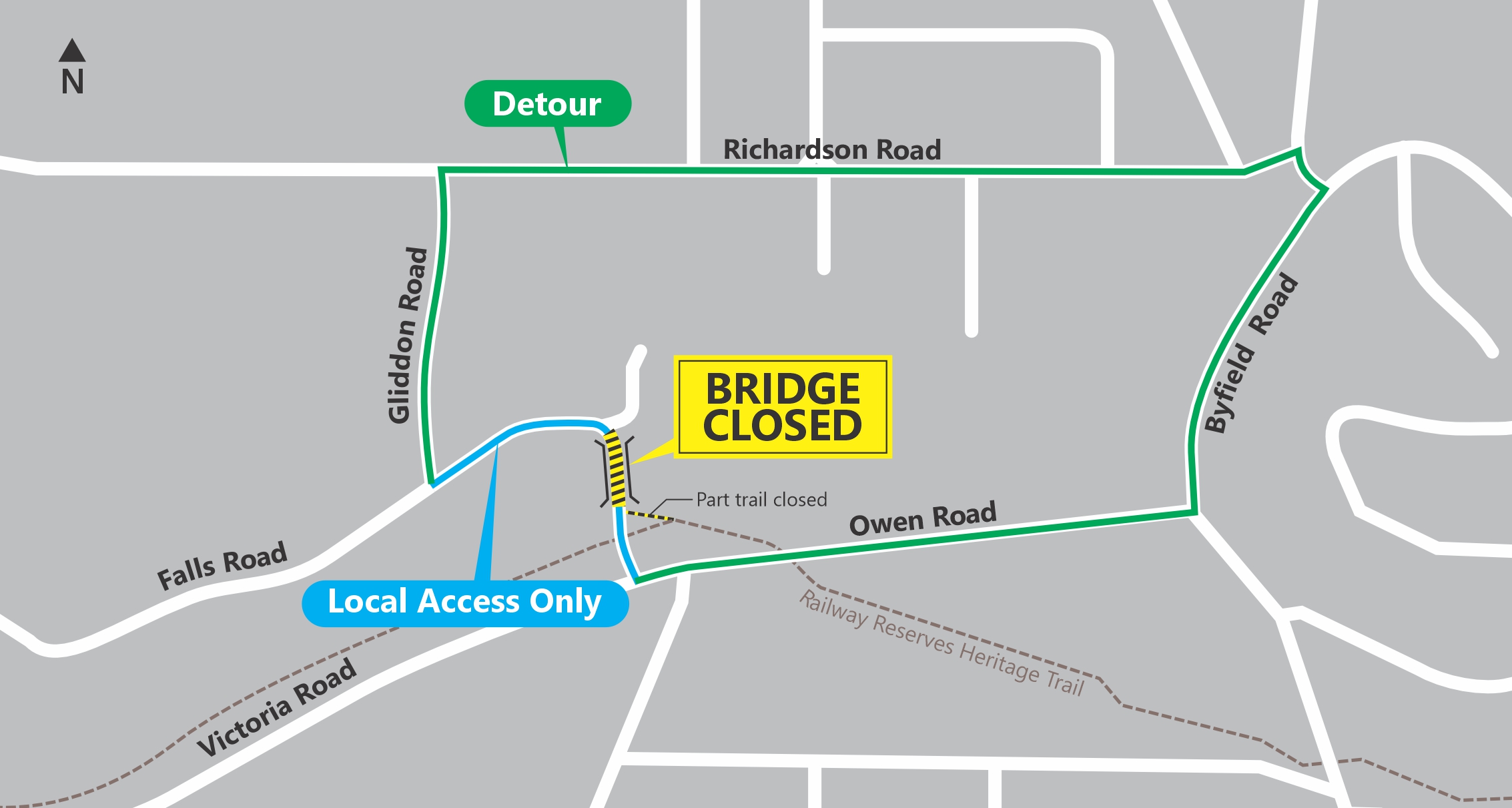
Falls Rd Bridge Parkerville - Upgrades
Local Road — Parkerville

Map preview · about 20 KB · © OpenStreetMap
Roads · Power outages · Air quality
Works: Falls Rd Bridge Parkerville - Upgrades
Work type: Upgrades
Traffic impact: Closed for demolition and replacement. Detours in place for all traffic, pedestrians and cyclists. Click 'Find out more' for a detour map.
Starts (AWST): 01/07/2026 07:00:00
Estimated completion (AWST): 31/12/2026 23:59:00
- Location
- -31.8781, 116.1311
- Source
- The Commissioner of Main Roads is the creator and owner of the data and Licenced Material, which is accessed pursuant to a Creative Commons (Attribution) Licence, which has a disclaimer of warranties and limitation of liability. CC BY 4.0. Adapted to canonical Items.
OpenStreetMap Open on the full interactive mapWestern Australia warnings
Nearby
Planned outage510 m away
Planned outage971 m away
Smoke alert4.3 km away
Smoke Alert For Mundaring, Sawyers Valley, Chidlow And Surrounding Areas In The Shire Of Mundaring.
Planned outage4.4 km away
Scheduled roadwork4.6 km away
Great Eastern Hwy And Chipper St, Mundaring - Utility Works 7am-3pm
Planned outage4.8 km away
Burn off7.6 km away
Scheduled roadwork8.3 km away
Toodyay Rd And Stoneville Rd, Gidgegannup - Maintenance 7am-5pm