Charters Towers · council area
Needs action
No Emergency Warnings or Watch and Act alerts right now.
Show map of Charters Towersabout 20 KB · loads only when opened▾ Hide map
Map preview · about 20 KB · © OpenStreetMap
Current items by layer
Some other sources for Queensland aren't on this page yet, so this list may be incomplete
Nothing current for Fire, Burn areas or Earthquakes.
Live flood data for Queensland isn't available here yet
Live weather data for Queensland isn't available here yet
Live water supply data for Queensland isn't available here yet
Live algal blooms data for Queensland isn't available here yet
Live dams data for Queensland isn't available here yet
Live sharksmart data for Queensland isn't available here yet
Roads 1
Road damageHazard — Mt Spec Road — Crystal CreekCrystal Creek · QLD ·
Show map of Hazard — Mt Spec Road — Crystal Creekabout 20 KB · loads only when opened▾ Hide map
Map preview · about 20 KB · © OpenStreetMap
Event: Hazard Type: Road damage Road: Mt Spec Road Location: Crystal Creek Description: Crystal Creek to Paluma Impact: All lanes affected Direction: Both directions Delays: Long delays expected…
Updated 21 Oct, 9:38 am AEST · -19.0030, 146.2454
Details OpenStreetMap Source (Department of Transport and Main Roads)
Other 5
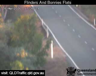
Flood cameraCampaspe - Flinders Highway At Bonnies Flats - EastCapaspe · QLD
Show map of Campaspe - Flinders Highway At Bonnies Flats - Eastabout 20 KB · loads only when opened▾ Hide map
Map preview · about 20 KB · © OpenStreetMap
Camera: Flood camera location; does not indicate flooding Direction: East Location: Capaspe Information: New images available every 30 minutes between 6am and 6pm. View camera image
-20.2323, 145.8747
Details OpenStreetMap Source (State of Queensland (Department of Transport and Main Roads))
Flood cameraHomestead - Flinders Highway At Shovel Creek - WestQLD
Show map of Homestead - Flinders Highway At Shovel Creek - Westabout 20 KB · loads only when opened▾ Hide map
Map preview · about 20 KB · © OpenStreetMap
Camera: Flood camera location; does not indicate flooding Direction: West Location: Homestead Information: New images available every 30 minutes between 6am and 6pm. View camera image
-20.3228, 145.7095
Details OpenStreetMap Source (State of Queensland (Department of Transport and Main Roads))
Flood cameraMacrossan - Flinders Highway At Burdekin River - WestQLD
Show map of Macrossan - Flinders Highway At Burdekin River - Westabout 20 KB · loads only when opened▾ Hide map
Map preview · about 20 KB · © OpenStreetMap
Camera: Flood camera location; does not indicate flooding Direction: West Location: Macrossan Information: New images available every 30 minutes between 6am and 6pm. View camera image
-19.9987, 146.4405
Details OpenStreetMap Source (State of Queensland (Department of Transport and Main Roads))
Flood cameraSeventy Mile - Gregory Highway At Cape River - SouthQLD
Show map of Seventy Mile - Gregory Highway At Cape River - Southabout 20 KB · loads only when opened▾ Hide map
Map preview · about 20 KB · © OpenStreetMap
Camera: Flood camera location; does not indicate flooding Direction: South Location: Seventy Mile Information: New images available every 30 minutes between 6am and 6pm. View camera image
-20.9953, 146.4257
Details OpenStreetMap Source (State of Queensland (Department of Transport and Main Roads))
Flood cameraSouthern Cross - Gregory Highway At Hann Creek - SouthQLD
Show map of Southern Cross - Gregory Highway At Hann Creek - Southabout 20 KB · loads only when opened▾ Hide map
Map preview · about 20 KB · © OpenStreetMap
Camera: Flood camera location; does not indicate flooding Direction: South Location: Southern Cross Information: New images available every 30 minutes between 6am and 6pm. View camera image
-19.8940, 146.2099
Details OpenStreetMap Source (State of Queensland (Department of Transport and Main Roads))


Also in
Postcodes: 4820, 4816, 4817, 4850
Suburbs: Richmond Hill (Qld), Charters Towers City, Queenton, Broughton (Qld), Toll, Southern Cross (Qld)