Ipswich · council area
Needs action
No Emergency Warnings or Watch and Act alerts right now.
Show map of Ipswichabout 20 KB · loads only when opened▾ Hide map
Map preview · about 20 KB · © OpenStreetMap
Current items by layer
Some other sources for Queensland aren't on this page yet, so this list may be incomplete
Nothing current for Fire, Burn areas or Earthquakes.
Live flood data for Queensland isn't available here yet
Live weather data for Queensland isn't available here yet
Live water supply data for Queensland isn't available here yet
Live algal blooms data for Queensland isn't available here yet
Live dams data for Queensland isn't available here yet
Live sharksmart data for Queensland isn't available here yet
Roads 1
Road damageHazard — Rosewood Marburg Road — Rosewood / TallegallaRosewood / Tallegalla · QLD ·
Show map of Hazard — Rosewood Marburg Road — Rosewood / Tallegallaabout 20 KB · loads only when opened▾ Hide map
Map preview · about 20 KB · © OpenStreetMap
Event: Hazard Type: Road damage Road: Rosewood Marburg Road Location: Rosewood / Tallegalla Description: Rosewood Marburg Road Embankment Restoration Works. Impact: All lanes affected Direction:…
Updated 29 Sept, 8:37 pm AEST · -27.6124, 152.5800
Details OpenStreetMap Source (Department of Transport and Main Roads)
Other 3
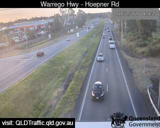
Traffic cameraBundamba - Warrego Highway Near Hoepner Road - WestQLD
Show map of Bundamba - Warrego Highway Near Hoepner Road - Westabout 20 KB · loads only when opened▾ Hide map
Map preview · about 20 KB · © OpenStreetMap
Camera: Traffic camera location Direction: West Location: Bundamba View camera image
-27.5880, 152.8230
Details OpenStreetMap Source (State of Queensland (Department of Transport and Main Roads))
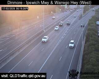
Traffic cameraDinmore - Ipswich Motorway & Warrego Highway - WestQLD
Show map of Dinmore - Ipswich Motorway & Warrego Highway - Westabout 20 KB · loads only when opened▾ Hide map
Map preview · about 20 KB · © OpenStreetMap
Camera: Traffic camera location Direction: West Location: Dinmore View camera image
-27.5957, 152.8415
Details OpenStreetMap Source (State of Queensland (Department of Transport and Main Roads))
Traffic cameraGoodna - Ipswich Motorway & Railway Terrace - EastDinmore · QLD
Show map of Goodna - Ipswich Motorway & Railway Terrace - Eastabout 20 KB · loads only when opened▾ Hide map
Map preview · about 20 KB · © OpenStreetMap
Camera: Traffic camera location Direction: SouthEast Location: Dinmore View camera image
-27.6016, 152.8866
Details OpenStreetMap Source (State of Queensland (Department of Transport and Main Roads))
Also in
Postcodes: 4300, 4301, 4304, 4303, 4305, 4346
Suburbs: Redbank Plains, Springfield Lakes, Brassall, Goodna, Raceview, Collingwood Park (Qld)