Lockyer Valley · council area
Needs action
No Emergency Warnings or Watch and Act alerts right now.
Show map of Lockyer Valleyabout 20 KB · loads only when opened▾ Hide map
Map preview · about 20 KB · © OpenStreetMap
Current items by layer
- Flood1No warnings
- Roads4No warnings+1 planned or other
- Power outages1No warnings+1 planned or other
- Other6No warnings
Some flood sources for Queensland aren't on this page yet, so this list may be incomplete
Some other sources for Queensland aren't on this page yet, so this list may be incomplete
Nothing current for Fire, Burn areas or Earthquakes.
Live weather data for Queensland isn't available here yet
Live water supply data for Queensland isn't available here yet
Live algal blooms data for Queensland isn't available here yet
Live dams data for Queensland isn't available here yet
Live sharksmart data for Queensland isn't available here yet
Flood 1
Waze hazard weather floodWaze Hazard Weather Flood — Lawlers RdHelidon · QLD ·
Show map of Waze Hazard Weather Flood — Lawlers Rdabout 20 KB · loads only when opened▾ Hide map
Map preview · about 20 KB · © OpenStreetMap
Report: Waze community report — hazard weather flood Road: Lawlers Rd Location: Helidon Description: Water Over Road
Updated 22 Oct, 9:08 am AEST · -27.5625, 152.1515
Details OpenStreetMap Source (Waze community reports via QLDTraffic)
Roads 4
Road damageHazard — Sandy Creek Road — GranthamGrantham · QLD ·
Show map of Hazard — Sandy Creek Road — Granthamabout 20 KB · loads only when opened▾ Hide map
Map preview · about 20 KB · © OpenStreetMap
Event: Hazard Type: Road damage Cause: Rough surface Road: Sandy Creek Road Location: Grantham Description: Rough Surface - Observe Signage Impact: All lanes affected Direction: All directions…
Updated 19 Oct, 6:46 am AEST · -27.5311, 152.1860
Details OpenStreetMap Source (Lockyer Valley Regional Council)
Road damageHazard — Laidley Creek West Road — MulgowieMulgowie · QLD ·
Show map of Hazard — Laidley Creek West Road — Mulgowieabout 20 KB · loads only when opened▾ Hide map
Map preview · about 20 KB · © OpenStreetMap
Event: Hazard Type: Road damage Cause: Earlier flooding Road: Laidley Creek West Road Location: Mulgowie Description: Road Closed - Seek Alternative Route Impact: Road closed to all traffic…
Updated 8 Oct, 6:00 am AEST · -27.7090, 152.3569
Details OpenStreetMap Source (Lockyer Valley Regional Council)
Road damageHazard — Lefthand Branch Road — Lefthand BranchLefthand Branch · QLD ·
Show map of Hazard — Lefthand Branch Road — Lefthand Branchabout 20 KB · loads only when opened▾ Hide map
Map preview · about 20 KB · © OpenStreetMap
Event: Hazard Type: Road damage Cause: Soft shoulders Road: Lefthand Branch Road Location: Lefthand Branch Impact: Lane or lanes reduced Direction: Eastbound Towards: Lindemayer Lane Advice: Observe…
Updated 29 Sept, 6:42 am AEST · -27.7401, 152.2377
Details OpenStreetMap Source (Lockyer Valley Regional Council)
Road damageHazard — Mountain View Drive — PlainlandPlainland · QLD ·
Show map of Hazard — Mountain View Drive — Plainlandabout 20 KB · loads only when opened▾ Hide map
Map preview · about 20 KB · © OpenStreetMap
Event: Hazard Type: Road damage Cause: Rough surface Road: Mountain View Drive Location: Plainland Description: Part Shoulder Closed - Road Damage - Observe Signage Impact: Lane or lanes reduced…
Updated 29 Sept, 6:42 am AEST · -27.5552, 152.4288
Details OpenStreetMap Source (Lockyer Valley Regional Council)
Power outages 1
Unplanned outagePower Outage — Redwood, ToowoombaRedwood, Toowoomba · QLD
Show map of Power Outage — Redwood, Toowoombaabout 20 KB · loads only when opened▾ Hide map
Map preview · about 20 KB · © OpenStreetMap
Crews working on-site · The loss of supply is due to damage caused by storm activity. · 9 customers affected
-27.5757, 151.9913
Other 6
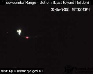
Traffic cameraToowoomba - Bottom Of Range - EastToowoomba City · QLD
Show map of Toowoomba - Bottom Of Range - Eastabout 20 KB · loads only when opened▾ Hide map
Map preview · about 20 KB · © OpenStreetMap
Camera: Traffic camera location Direction: NorthEast Location: Toowoomba City View camera image
-27.5620, 152.0048
Details OpenStreetMap Source (State of Queensland (Department of Transport and Main Roads))
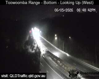
Traffic cameraToowoomba - Bottom Of Range - WestToowoomba City · QLD
Show map of Toowoomba - Bottom Of Range - Westabout 20 KB · loads only when opened▾ Hide map
Map preview · about 20 KB · © OpenStreetMap
Camera: Traffic camera location Direction: SouthWest Location: Toowoomba City View camera image
-27.5632, 152.0031
Details OpenStreetMap Source (State of Queensland (Department of Transport and Main Roads))
Traffic cameraToowoomba Bypass - Toowoomba Connection Road - WestQLD
Show map of Toowoomba Bypass - Toowoomba Connection Road - Westabout 20 KB · loads only when opened▾ Hide map
Map preview · about 20 KB · © OpenStreetMap
Camera: Traffic camera location Direction: West Location: Toowoomba View camera image
-27.5477, 152.0868
Details OpenStreetMap Source (State of Queensland (Department of Transport and Main Roads))
Traffic cameraToowoomba Bypass - Second Range Crossing Warrego Highway - WestQLD
Show map of Toowoomba Bypass - Second Range Crossing Warrego Highway - Westabout 20 KB · loads only when opened▾ Hide map
Map preview · about 20 KB · © OpenStreetMap
Camera: Traffic camera location Direction: West Location: Toowoomba View camera image
-27.5454, 152.0818
Details OpenStreetMap Source (State of Queensland (Department of Transport and Main Roads))
Traffic cameraLockyer Valley - Warrego Highway At Glenore Grove - NorthwestGlenore Grove · QLD
Show map of Lockyer Valley - Warrego Highway At Glenore Grove - Northwestabout 20 KB · loads only when opened▾ Hide map
Map preview · about 20 KB · © OpenStreetMap
Camera: Traffic camera location Direction: NorthWest Location: Glenore Grove View camera image
-27.5541, 152.3921
Details OpenStreetMap Source (State of Queensland (Department of Transport and Main Roads))


Also in
Postcodes: 4341, 4343, 4344, 4347, 4342, 4311
Suburbs: Gatton, Laidley, Regency Downs, Withcott, Kensington Grove, Plainland