Scheduled roadwork
Roadworks — Nicklin Way / Sunshine Motorway — Minyama / Mooloolaba
Minyama / Mooloolaba
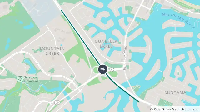
Map preview · about 20 KB · © OpenStreetMap
Published · Updated (9 hr ago)
Event: Roadworks
Type: Planned roadworks
Road: Nicklin Way / Sunshine Motorway
Location: Minyama / Mooloolaba
Description: Sections of the Sunshine Motorway, Nicklin Way and Kawana Way.
Impact: Lane or lanes blocked
Direction: Southbound
Towards: Caloundra
Delays: Delays expected (during active hours)
Advice: Observe signage
Information: • Early works have commenced for the Mooloolah River Interchange (MRI) Upgrade Stage 1, including site preparation, clearing, service relocations and geotechnical investigations to prepare for major earthworks in 2026, prior to main construction.
• Daytime works will be between 7am and 6pm (Monday to Friday), with occasional weekend work.
• Some nightworks will be undertaken between 6pm and 6am, including occasional weekends. This may include ramp and road closures which will be signed prior to closures.
• Reduced speed limits, construction signage and traffic control will be present.
• Potential delays due to temporary lane closures and redirections may occur.
• Potential construction noise, light, vibration and dust may be experienced within the project footprint.
• The active transport pathway on Seriata Way has now been permanently closed.
• The public carpark on Brisbane Road (via Incana Court) has now been permanently closed
- Location
- -26.6932, 153.1112
- Source
- Department of Transport and Main Roads · Attribution
OpenStreetMap Open on the full interactive mapQueensland warnings
Nearby
Planned outage1.8 km away
Planned outage2.2 km away
Traffic camera2.3 km away
Traffic camera2.5 km away
Traffic camera3.5 km away
Alexandra Headland - Alexandra Parade & Parker Street - South
Traffic camera4.1 km away
Traffic camera4.5 km away
Traffic camera4.7 km away
Traffic camera5.2 km away
Traffic camera5.7 km away
Maroochydore - Maroochydore Road & Hume Street Intersection - West