Queensland
Needs action
No Emergency Warnings or Watch and Act alerts right now.
Current items by layer
- Fire273 Advice
- Flood93No warnings
- Roads96No warnings+330 planned or other
- Power outages17No warnings+324 planned or other
- SharkSmart1 planned or otherNo warnings
- Other259No warnings
Some flood sources for Queensland aren't on this page yet, so this list may be incomplete
Some sharksmart sources for Queensland aren't on this page yet, so this list may be incomplete
Some other sources for Queensland aren't on this page yet, so this list may be incomplete
Nothing current for Burn areas or Earthquakes.
Live weather data for Queensland isn't available here yet
Live water supply data for Queensland isn't available here yet
Live algal blooms data for Queensland isn't available here yet
Live dams data for Queensland isn't available here yet
Fire 27
AdviceFire warningAvoid Smoke - Archer River - Fire As At 2:27pm Wednesday, 21 October 2026Archer River And Surrounding Areas · QLD ·
Map preview · about 20 KB · © OpenStreetMap
Thick smoke is affecting Archer River and surrounding areas. This is from a fire burning on the Peninsula Developmetnal Road. This fire is not under control. This fire could burn for days. Protect…
Updated 21 Oct, 2:27 pm AEST · -13.2515, 142.7424
DetailsOpenStreetMapSource (© State of Queensland (Queensland Fire Department))
AdviceFire warningAvoid Smoke - Boyne Island And Tannum Sands - Fire As At 2:05pm Wednesday, 21 October 2026Boyne Island, Tannum Sands And Surrounding Areas · QLD ·
Map preview · about 20 KB · © OpenStreetMap
Thick smoke is affecting Boyne Island, Tannum Sands and surrounding areas. This is from a fire burning near Dahl Road, Tannum Sands. Fire crews are currently on scene. This fire is under control.…
Updated 21 Oct, 2:06 pm AEST · -23.9608, 151.3579
DetailsOpenStreetMapSource (© State of Queensland (Queensland Fire Department))
AdviceFire warningAvoid Smoke - Mackay - Fire As At 10:13am Wednesday, 21 October 2026Mackay And Surrounding Areas · QLD ·
Map preview · about 20 KB · © OpenStreetMap
Thick smoke is affecting Mackay and surrounding areas. This is from a fire burning near Evan Street and Binnington Esplanade, East Mackay. Fire crews are currently on scene. This fire is under…
Updated 21 Oct, 10:26 am AEST · -21.1594, 149.1710
DetailsOpenStreetMapSource (© State of Queensland (Queensland Fire Department))
Bushfire · GoingFire Vegetation — TaraTara · QLD ·
Map preview · about 20 KB · © OpenStreetMap
Incident type: FIRE VEGETATION Status: Going Location: BENNETTS SCHOOL RD Locality: TARA Region: 3 South Western Region Vehicles assigned: 2 Vehicles on route: 0 Vehicles on scene: 1 Position:…
Updated 21 Oct, 11:12 pm AEST · -27.2180, 150.3974
DetailsOpenStreetMapSource (© State of Queensland (Queensland Fire Department))
Planned burn · PatrolledFire Permitted Burn — BarringhaBarringha · QLD ·
Map preview · about 20 KB · © OpenStreetMap
Incident type: FIRE PERMITTED BURN Status: Patrolled Location: Old Flinders Hwy Locality: BARRINGHA Region: 1 Northern Region Vehicles assigned: 0 Vehicles on route: 0 Vehicles on scene: 0 Position:…
Updated 21 Oct, 11:02 pm AEST · -19.5643, 146.8354
DetailsOpenStreetMapSource (© State of Queensland (Queensland Fire Department))
Flood 92
Waze hazard weather floodWaze Hazard Weather Flood — Cottesloe DrRobina · QLD ·
Map preview · about 20 KB · © OpenStreetMap
Report: Waze community report — hazard weather flood Road: Cottesloe Dr Location: Robina
Updated 21 Oct, 10:29 pm AEST · -28.0677, 153.4145
DetailsOpenStreetMapSource (Waze community reports via QLDTraffic)
Waze hazard weather floodWaze Hazard Weather Flood — Sunshine BvdMermaid Waters · QLD ·
Map preview · about 20 KB · © OpenStreetMap
Report: Waze community report — hazard weather flood Road: Sunshine Bvd Location: Mermaid Waters
Updated 21 Oct, 10:08 pm AEST · -28.0447, 153.4266
DetailsOpenStreetMapSource (Waze community reports via QLDTraffic)
FloodingFlooding — Ward Road — Tambo / WardTambo / Ward · QLD ·
Map preview · about 20 KB · © OpenStreetMap
Event: Flooding Type: Long-term flooding Cause: Heavy rain Road: Ward Road Location: Tambo / Ward Description: Tambo to Ward (Tambo to Murweh Council boundary) Impact: Road closed to all traffic…
Updated 21 Oct, 9:58 pm AEST · -25.2259, 146.1215
DetailsOpenStreetMapSource (Department of Transport and Main Roads)
FloodingFlooding — Langlo Road — Langlo / MacfarlaneLanglo / Macfarlane · QLD ·
Map preview · about 20 KB · © OpenStreetMap
Event: Flooding Type: Long-term flooding Cause: Heavy rain Road: Langlo Road Location: Langlo / MacFarlane Description: Tambo to Langlo (Tambo to Murweh Council Boundary) Impact: Road closed to all…
Updated 21 Oct, 9:58 pm AEST · -25.1691, 145.7807
DetailsOpenStreetMapSource (Department of Transport and Main Roads)
FloodingFlooding — Neverfail Road — BlackallBlackall · QLD ·
Map preview · about 20 KB · © OpenStreetMap
Event: Flooding Type: Long-term flooding Cause: Heavy rain Road: Neverfail Road Location: Blackall Description: Yalleroi Reserve (turn off from Blackall Jericho Road) to junction with Tumbar Road…
Updated 21 Oct, 9:57 pm AEST · -24.0906, 146.0119
DetailsOpenStreetMapSource (Department of Transport and Main Roads)
Roads 97
CrashCrash — Waterford Tamborine Road — TamborineTamborine · QLD ·
Map preview · about 20 KB · © OpenStreetMap
Event: Crash Type: Single vehicle Road: Waterford Tamborine Road Location: Tamborine Description: North of Curlew court Impact: Lane or lanes reduced Direction: Unknown Advice: Proceed with caution
Updated 21 Oct, 11:16 pm AEST · -27.8208, 153.1002
DetailsOpenStreetMapSource (Department of Transport and Main Roads)
Stationary vehicleHazard — Pacific Motorway — LoganholmeLoganholme · QLD ·
Map preview · about 20 KB · © OpenStreetMap
Event: Hazard Type: Stationary vehicle Road: Pacific Motorway Location: Loganholme Description: Near Exit 31 Impact: Lane or lanes reduced Direction: Northbound Towards: Logan Delays: Delays expected…
Updated 21 Oct, 11:00 pm AEST · -27.6933, 153.1935
DetailsOpenStreetMapSource (Department of Transport and Main Roads)
Waze hazard weather fogWaze Hazard Weather Fog — A3 - New England HwyBlue Mountain Heights · QLD ·
Map preview · about 20 KB · © OpenStreetMap
Report: Waze community report — hazard weather fog Road: A3 - New England Hwy Location: Blue Mountain Heights
Updated 21 Oct, 10:26 pm AEST · -27.5008, 151.9540
DetailsOpenStreetMapSource (Waze community reports via QLDTraffic)
Adverse driving conditionsHazard — Kennedy Developmental Road — LyndhurstLyndhurst · QLD ·
Map preview · about 20 KB · © OpenStreetMap
Event: Hazard Type: Adverse driving conditions Road: Kennedy Developmental Road Location: Lyndhurst Description: Between Porcupine and Lyndhurst Direction: Both directions Advice: Changed traffic…
Updated 21 Oct, 9:56 pm AEST · -19.5385, 144.2496
DetailsOpenStreetMapSource (Department of Transport and Main Roads)
Adverse driving conditionsHazard — Kennedy Highway (Barron River Bridge) — KurandaKuranda · QLD ·
Map preview · about 20 KB · © OpenStreetMap
Event: Hazard Type: Adverse driving conditions Road: Kennedy Highway (Barron River Bridge) Location: Kuranda Description: Barron River Bridge Kuranda Impact: Subject to a 42.5 tonne GVM limit…
Updated 21 Oct, 9:56 pm AEST · -16.8163, 145.6340
DetailsOpenStreetMapSource (Department of Transport and Main Roads)
Power outages 16
Unplanned outagePower Outage — BuderimBuderim · QLD
Map preview · about 20 KB · © OpenStreetMap
Awaiting · Powerlines down · 165 customers affected · Estimated restoration: 22 Oct, 2:00 am AEST
-26.6877, 153.0751
Unplanned outagePower Outage — BuddinaBuddina · QLD
Map preview · about 20 KB · © OpenStreetMap
In Progress · Under Investigation · 155 customers affected · Estimated restoration: 21 Oct, 11:30 pm AEST
-26.6927, 153.1351
Unplanned outagePower Outage — IlfracombeIlfracombe · QLD
Map preview · about 20 KB · © OpenStreetMap
Work delayed - crews unable to continue · The loss of supply is due to damage requiring emergency repairs. Fault finding is in progress. · 11 customers affected
-23.8727, 144.3128
Unplanned outagePower Outage — BarcaldineBarcaldine · QLD
Map preview · about 20 KB · © OpenStreetMap
Work delayed - crews unable to continue · The loss of supply is due to damage caused by storm activity. · 25 customers affected
-23.6517, 145.1001
Unplanned outagePower Outage — Consuelo, Injune, RollestonConsuelo, Injune, Rolleston · QLD
Map preview · about 20 KB · © OpenStreetMap
Crews working on-site · The loss of supply is due to damage requiring emergency repairs. Fault finding is in progress. · 133 customers affected
-24.8183, 148.6959
Other 259
Technical rescue · GoingRescue Technical — TalwoodTalwood · QLD ·
Map preview · about 20 KB · © OpenStreetMap
Incident type: RESCUE TECHNICAL Status: Going Location: BARWON HWY Locality: TALWOOD Region: 3 South Western Region Vehicles assigned: 2 Vehicles on route: 0 Vehicles on scene: 0 Position:…
Updated 21 Oct, 11:08 pm AEST · -28.4831, 149.4404
DetailsOpenStreetMapSource (© State of Queensland (Queensland Fire Department))
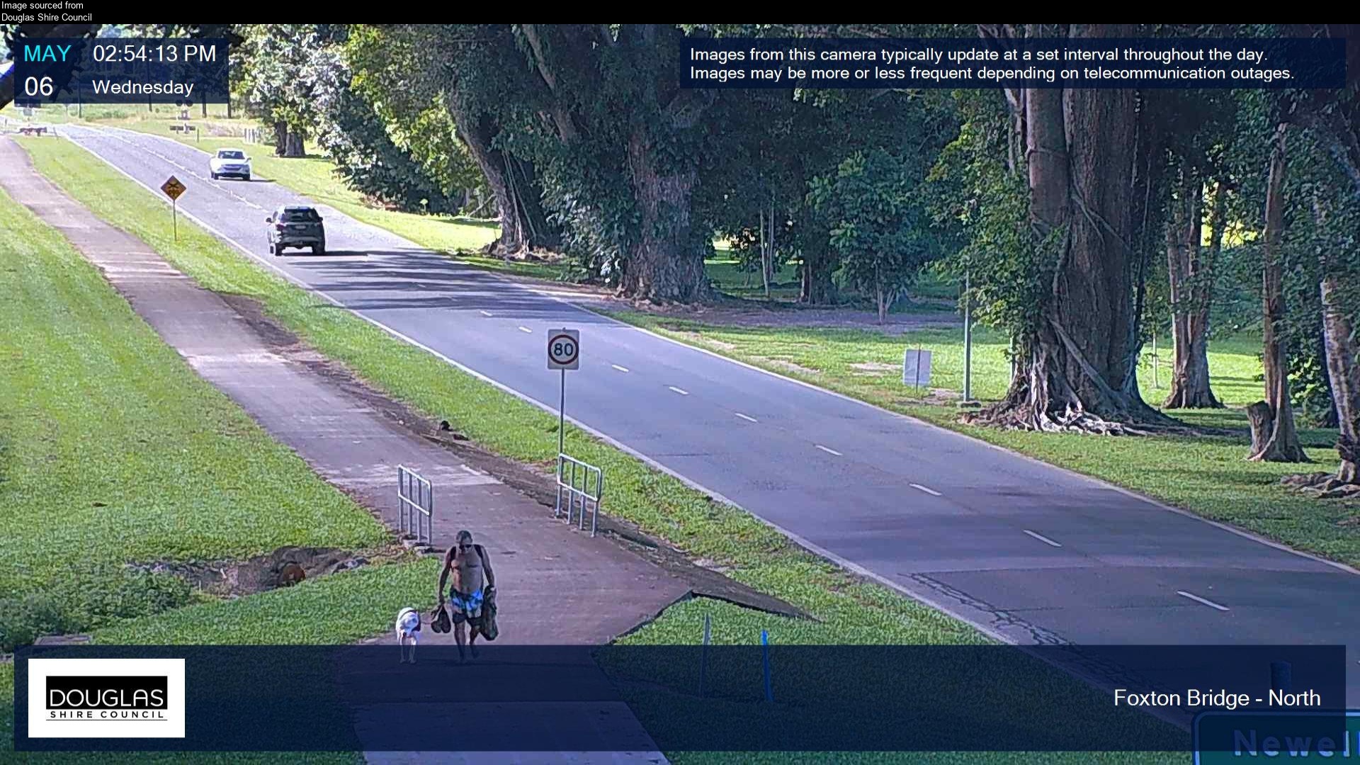
Flood cameraMossman - Mossman Daintree Road At Foxton Bridge - NorthQLD
Map preview · about 20 KB · © OpenStreetMap
Camera: Flood camera location; does not indicate flooding Direction: North Location: Mossman Image supplied by: Douglas Shire Council View camera image
-16.4516, 145.3717
Flood cameraSt Ruth - Dalby - Cecil Plains Road At Ashall CreekQLD
Map preview · about 20 KB · © OpenStreetMap
Camera: Flood camera location; does not indicate flooding Direction: North Location: St Ruth Information: New images available every 30 minutes. Images between 6pm and 6am may be of reduced quality…
-27.3915, 151.2694
DetailsOpenStreetMapSource (State of Queensland (Department of Transport and Main Roads))
Flood cameraGoondiwindi - Leichhardt Highway At Yarrill CreekQLD
Map preview · about 20 KB · © OpenStreetMap
Camera: Flood camera location; does not indicate flooding Direction: North Location: Goondiwindi Information: New images available every 30 minutes. Images between 6pm and 6am may be of reduced…
-28.2995, 150.2952
DetailsOpenStreetMapSource (State of Queensland (Department of Transport and Main Roads))
Flood cameraTummaville - Millmerran - Leyburn Road At Canal CreekQLD
Map preview · about 20 KB · © OpenStreetMap
Camera: Flood camera location; does not indicate flooding Direction: South Location: Tummaville Information: New images available every 30 minutes. Images between 6pm and 6am may be of reduced…
-27.9081, 151.5507
DetailsOpenStreetMapSource (State of Queensland (Department of Transport and Main Roads))