Drone surveillance
Drone Surveillance Location — The Wreck
The Wreck, Byron Bay
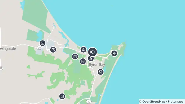
Map preview · about 20 KB · © OpenStreetMap
SharkSmart · Roads · Power outages
Drone surveillance location — The Wreck
Source notification history (dates as supplied by SharkSmart)
Drone Location — 2026-10-27T11:00:06.555Z
Drones operate from this location
SLS drone paused — 2026-10-07T19:53:00Z
SLS advise that the drone at The Wreck is temporarily grounded, 6:53 AM, 08 Oct 2026. Please be #SharkSmart
SLS - no sightings in last 30 minutes — 2026-09-26T01:55:10.076000Z
SLSNSW advise that no sharks have been sighted in the last 30 minutes after the water was evacuated earlier after a shark sighting at The Wreck, 11:55 AM, 26 Sep 2026. Please be #SharkSmart
SLS drone sighting — 2026-09-26T01:16:52.622000Z
SLSNSW advise a shark was sighted by drone at The Wreck at 11:16 AM on 26 Sep 2026. Beach Closed Please be #SharkSmart
SLS drone sighting — 2026-09-04T22:43:00Z
SLSNSW advise a shark was sighted by drone at The Wreck at 8:43 AM on 05 Sep 2026. water Evacuated Please be #SharkSmart
SLS drone sighting — 2026-08-16T02:21:00Z
SLSNSW advise a shark was sighted by drone at The Wreck at 12:21 PM on 16 Aug 2026. Water evacuated by SLS drone Please be #SharkSmart
SLS - no sightings in last hour — 2026-08-13T01:00:00Z
SLSNSW advise that no sharks have been sighted in the last hour after the water was evacuated earlier after a shark sighting at The Wreck, 11:00 AM, 13 Aug 2026. Beach Opened Please be #SharkSmart
SLS drone sighting — 2026-08-13T00:19:00Z
SLSNSW advise a shark was sighted by drone at The Wreck at 10:19 AM on 13 Aug 2026. Beach Closed Please be #SharkSmart
SLS - no sightings in last hour — 2026-08-13T00:04:00Z
SLSNSW advise that no sharks have been sighted in the last hour after the water was evacuated earlier after a shark sighting at The Wreck, 10:04 AM, 13 Aug 2026. Beach Opened Please be #SharkSmart
SLS drone sighting — 2026-08-12T23:09:00Z
SLSNSW advise a shark was sighted by drone at The Wreck at 9:09 AM on 13 Aug 2026. Beach Closed Please be #SharkSmart
- Location
- -28.6405, 153.6146
- Source
- Data © State of NSW (SharkSmart). Refer to SharkSmart for current information.
OpenStreetMap Open on the full interactive mapNew South Wales warnings
Nearby
Changed traffic conditions370 m away
Drone surveillance543 m away
Planned outage566 m away
Planned outage579 m away
Planned outage1.0 km away
Drone surveillance1.3 km away
Tagged shark receiver1.3 km away
Planned outage2.2 km away
Planned outage2.6 km away
Planned outage2.7 km away