4352 · postcode
Needs action
No Emergency Warnings or Watch and Act alerts right now.
Show map of 4352about 20 KB · loads only when opened▾ Hide map
Map preview · about 20 KB · © OpenStreetMap
Current items by layer
- Flood8No warnings
- Roads1No warnings+5 planned or other
- Power outages4 planned or otherNo warnings
- Other2No warnings
Some flood sources for Queensland aren't on this page yet, so this list may be incomplete
Some other sources for Queensland aren't on this page yet, so this list may be incomplete
Nothing current for Fire, Burn areas or Earthquakes.
Live weather data for Queensland isn't available here yet
Live water supply data for Queensland isn't available here yet
Live algal blooms data for Queensland isn't available here yet
Live dams data for Queensland isn't available here yet
Live sharksmart data for Queensland isn't available here yet
Roads 6
Level: All levels · Emergency Warning · Watch and Act · Advice
Scheduled roadworkRoadworks — Brookstead Norwin Road — BranchviewBranchview · QLD ·
Show map of Roadworks — Brookstead Norwin Road — Branchviewabout 20 KB · loads only when opened▾ Hide map
Map preview · about 20 KB · © OpenStreetMap
Event: Roadworks Type: Planned roadworks Road: Brookstead Norwin Road Location: Branchview Description: Between Branchview and Lonepine Road E Impact: Lane or lanes reduced Direction: Both directions…
Updated 28 Oct, 11:44 pm AEST · -27.6309, 151.3480
Details OpenStreetMap Source (Department of Transport and Main Roads)
Debris on roadHazard — Kelvinhaugh Boodua Road / Lewis Road — Boodua / YalangurBoodua / Yalangur · QLD ·
Show map of Hazard — Kelvinhaugh Boodua Road / Lewis Road — Boodua / Yalangurabout 20 KB · loads only when opened▾ Hide map
Map preview · about 20 KB · © OpenStreetMap
Event: Hazard Type: Debris on road Cause: Fallen vegetation Road: Kelvinhaugh Boodua Road / Lewis Road Location: Boodua / Yalangur Description: A very large tree is blocking the full road Impact:…
Updated 28 Oct, 5:00 pm AEST · -27.4010, 151.8103
Scheduled roadworkRoadworks — New England Highway — Crows Nest / PecheyCrows Nest / Pechey · QLD ·
Show map of Roadworks — New England Highway — Crows Nest / Pecheyabout 20 KB · loads only when opened▾ Hide map
Map preview · about 20 KB · © OpenStreetMap
Event: Roadworks Type: Planned roadworks Road: New England Highway Location: Crows Nest / Pechey Description: Between Crows Nest Showgrounds and Pechey Forestry Road Impact: Lane or lanes reduced…
Updated 27 Oct, 10:48 am AEST · -27.2809, 152.0504
Details OpenStreetMap Source (Department of Transport and Main Roads)
Scheduled roadworkRoadworks — Highfields Road — HighfieldsHighfields · QLD ·
Show map of Roadworks — Highfields Road — Highfieldsabout 20 KB · loads only when opened▾ Hide map
Map preview · about 20 KB · © OpenStreetMap
Event: Roadworks Type: Planned roadworks Road: Highfields Road Location: Highfields Description: Staged works as part of Highfields Road intersection project - intersection of Highfields and Kratzke…
Updated 7 Oct, 7:12 am AEST · -27.4529, 151.9448
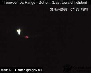
Traffic cameraToowoomba - Bottom Of Range - EastToowoomba City · QLD
Show map of Toowoomba - Bottom Of Range - Eastabout 20 KB · loads only when opened▾ Hide map
Map preview · about 20 KB · © OpenStreetMap
Camera: Traffic camera location Direction: NorthEast Location: Toowoomba City View camera image
-27.5620, 152.0048
Details OpenStreetMap Source (State of Queensland (Department of Transport and Main Roads))
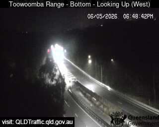
Traffic cameraToowoomba - Bottom Of Range - WestToowoomba City · QLD
Show map of Toowoomba - Bottom Of Range - Westabout 20 KB · loads only when opened▾ Hide map
Map preview · about 20 KB · © OpenStreetMap
Camera: Traffic camera location Direction: SouthWest Location: Toowoomba City View camera image
-27.5632, 152.0031
Details OpenStreetMap Source (State of Queensland (Department of Transport and Main Roads))
Also in
Council areas: Toowoomba, Lockyer Valley, Southern Downs, Goondiwindi
Suburbs: Highfields (Qld), Meringandan West, Gowrie Junction, Kleinton, Wyreema, Withcott