Queensland
Needs action
No Emergency Warnings or Watch and Act alerts right now.
Current items by layer
- Fire31No warnings
- Flood276No warnings
- Roads85No warnings+318 planned or other
- Power outages15No warnings+512 planned or other
- SharkSmart1 planned or otherNo warnings
- Other259No warnings
Some flood sources for Queensland aren't on this page yet, so this list may be incomplete
Some sharksmart sources for Queensland aren't on this page yet, so this list may be incomplete
Some other sources for Queensland aren't on this page yet, so this list may be incomplete
Nothing current for Burn areas or Earthquakes.
Live weather data for Queensland isn't available here yet
Live water supply data for Queensland isn't available here yet
Live algal blooms data for Queensland isn't available here yet
Live dams data for Queensland isn't available here yet
Other 259
Level: All levels · Emergency Warning · Watch and Act · Advice
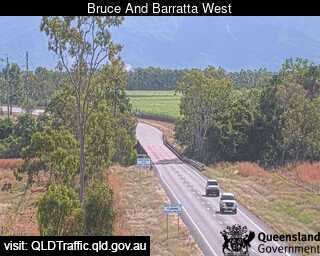
Flood cameraBarratta - Bruce Highway At Barratta Creek West - WestQLD
Show map of Barratta - Bruce Highway At Barratta Creek West - Westabout 20 KB · loads only when opened▾ Hide map
Map preview · about 20 KB · © OpenStreetMap
Camera: Flood camera location; does not indicate flooding Direction: West Location: Barratta Information: New images available every 30 minutes between 6am and 6pm. View camera image
-19.5687, 147.2109
Details OpenStreetMap Source (State of Queensland (Department of Transport and Main Roads))
Flood cameraBemerside - Bruce Highway At Seymour River North - NorthQLD
Show map of Bemerside - Bruce Highway At Seymour River North - Northabout 20 KB · loads only when opened▾ Hide map
Map preview · about 20 KB · © OpenStreetMap
Camera: Flood camera location; does not indicate flooding Direction: North Location: Bemerside Information: New images available every 30 minutes between 6am and 6pm. View camera image
-18.5698, 146.1888
Details OpenStreetMap Source (State of Queensland (Department of Transport and Main Roads))
Flood cameraMacrossan - Flinders Highway At Burdekin River - WestQLD
Show map of Macrossan - Flinders Highway At Burdekin River - Westabout 20 KB · loads only when opened▾ Hide map
Map preview · about 20 KB · © OpenStreetMap
Camera: Flood camera location; does not indicate flooding Direction: West Location: Macrossan Information: New images available every 30 minutes between 6am and 6pm. View camera image
-19.9987, 146.4405
Details OpenStreetMap Source (State of Queensland (Department of Transport and Main Roads))
Flood cameraGairloch - Bruce Highway At Gairloch Washaway - SouthQLD
Show map of Gairloch - Bruce Highway At Gairloch Washaway - Southabout 20 KB · loads only when opened▾ Hide map
Map preview · about 20 KB · © OpenStreetMap
Camera: Flood camera location; does not indicate flooding Direction: South Location: Gairloch Information: New images available every 30 minutes between 6am and 6pm. View camera image
-18.6084, 146.1841
Details OpenStreetMap Source (State of Queensland (Department of Transport and Main Roads))
Flood cameraHelens Hill - Bruce Highway At Cattle Creek - SouthQLD
Show map of Helens Hill - Bruce Highway At Cattle Creek - Southabout 20 KB · loads only when opened▾ Hide map
Map preview · about 20 KB · © OpenStreetMap
Camera: Flood camera location; does not indicate flooding Direction: South Location: Helens Hill Information: New images available every 30 minutes between 6am and 6pm. View camera image
-18.7240, 146.1476
Details OpenStreetMap Source (State of Queensland (Department of Transport and Main Roads))
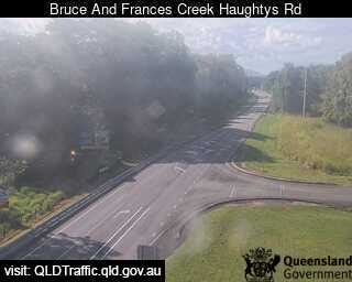
Flood cameraHelens Hill - Bruce Highway At Frances Creek (Haughtys Road) - SouthQLD
Show map of Helens Hill - Bruce Highway At Frances Creek (Haughtys Road) - Southabout 20 KB · loads only when opened▾ Hide map
Map preview · about 20 KB · © OpenStreetMap
Camera: Flood camera location; does not indicate flooding Direction: South Location: Helens Hill Information: New images available every 30 minutes between 6am and 6pm. View camera image
-18.7445, 146.1379
Details OpenStreetMap Source (State of Queensland (Department of Transport and Main Roads))
Flood cameraHelens Hill - Bruce Hwy At Helens Hill (Pombel Road) - SouthQLD
Show map of Helens Hill - Bruce Hwy At Helens Hill (Pombel Road) - Southabout 20 KB · loads only when opened▾ Hide map
Map preview · about 20 KB · © OpenStreetMap
Camera: Flood camera location; does not indicate flooding Direction: South Location: Helens Hill Information: New images available every 30 minutes between 6am and 6pm. View camera image
-18.7561, 146.1355
Details OpenStreetMap Source (State of Queensland (Department of Transport and Main Roads))
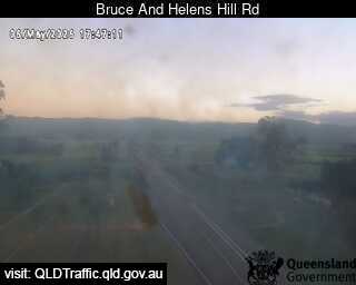
Flood cameraHelens Hill - Bruce Highway At Helens Hill Road - NorthQLD
Show map of Helens Hill - Bruce Highway At Helens Hill Road - Northabout 20 KB · loads only when opened▾ Hide map
Map preview · about 20 KB · © OpenStreetMap
Camera: Flood camera location; does not indicate flooding Direction: North Location: Helens Hill Information: New images available every 30 minutes between 6am and 6pm. View camera image
-18.7688, 146.1346
Details OpenStreetMap Source (State of Queensland (Department of Transport and Main Roads))
Flood cameraSeventy Mile - Gregory Highway At Cape River - SouthQLD
Show map of Seventy Mile - Gregory Highway At Cape River - Southabout 20 KB · loads only when opened▾ Hide map
Map preview · about 20 KB · © OpenStreetMap
Camera: Flood camera location; does not indicate flooding Direction: South Location: Seventy Mile Information: New images available every 30 minutes between 6am and 6pm. View camera image
-20.9953, 146.4257
Details OpenStreetMap Source (State of Queensland (Department of Transport and Main Roads))
Flood cameraSouthern Cross - Gregory Highway At Hann Creek - SouthQLD
Show map of Southern Cross - Gregory Highway At Hann Creek - Southabout 20 KB · loads only when opened▾ Hide map
Map preview · about 20 KB · © OpenStreetMap
Camera: Flood camera location; does not indicate flooding Direction: South Location: Southern Cross Information: New images available every 30 minutes between 6am and 6pm. View camera image
-19.8940, 146.2099
Details OpenStreetMap Source (State of Queensland (Department of Transport and Main Roads))
Flood cameraWangaratta - Bruce Highway At Yellow Gin Creek - SouthQLD
Show map of Wangaratta - Bruce Highway At Yellow Gin Creek - Southabout 20 KB · loads only when opened▾ Hide map
Map preview · about 20 KB · © OpenStreetMap
Camera: Flood camera location; does not indicate flooding Direction: South Location: Wangaratta Information: New images available every 30 minutes between 6am and 6pm. View camera image
-19.7851, 147.5247
Details OpenStreetMap Source (State of Queensland (Department of Transport and Main Roads))
Flood cameraCloncurry - Flinders Hwy At Canal CreekQLD
Show map of Cloncurry - Flinders Hwy At Canal Creekabout 20 KB · loads only when opened▾ Hide map
Map preview · about 20 KB · © OpenStreetMap
Camera: Flood camera location; does not indicate flooding Direction: East Location: Cloncurry Information: New images available every 30 minutes. Images between 6pm and 6am may be of reduced quality…
-20.6635, 140.8781
Details OpenStreetMap Source (State of Queensland (Department of Transport and Main Roads))
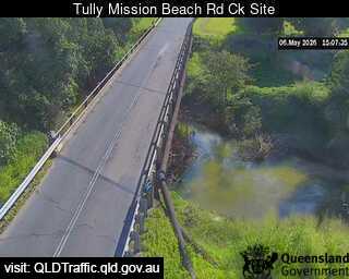
Flood cameraBirkalla - Tully Mission Beach Road At Banyan CreekQLD
Show map of Birkalla - Tully Mission Beach Road At Banyan Creekabout 20 KB · loads only when opened▾ Hide map
Map preview · about 20 KB · © OpenStreetMap
Camera: Flood camera location; does not indicate flooding Direction: West Location: Birkalla View camera image
-17.9130, 145.9551
Details OpenStreetMap Source (State of Queensland (Department of Transport and Main Roads))
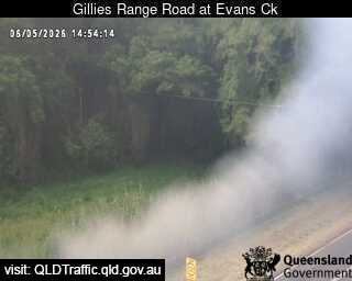
Flood cameraLittle Mulgrave - Gillies Range Road At Evans CreekQLD
Show map of Little Mulgrave - Gillies Range Road At Evans Creekabout 20 KB · loads only when opened▾ Hide map
Map preview · about 20 KB · © OpenStreetMap
Camera: Flood camera location; does not indicate flooding Direction: East Location: Little Mulgrave Information: New images available every 30 minutes. Images between 6pm and 6am may be of reduced…
-17.1412, 145.7507
Details OpenStreetMap Source (State of Queensland (Department of Transport and Main Roads))
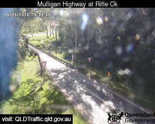
Flood cameraMount Molloy - Mulligan Highway At Rifle CreekQLD
Show map of Mount Molloy - Mulligan Highway At Rifle Creekabout 20 KB · loads only when opened▾ Hide map
Map preview · about 20 KB · © OpenStreetMap
Camera: Flood camera location; does not indicate flooding Direction: North Location: Mount Molloy Information: New images available every 30 minutes. Images between 6pm and 6am may be of reduced…
-16.6649, 145.3275
Details OpenStreetMap Source (State of Queensland (Department of Transport and Main Roads))
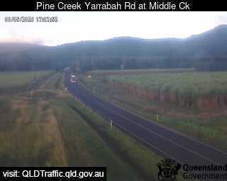
Flood cameraPackers Camp - Pine Creek Yarrabah Road At Middle CreekPacker's Camp · QLD
Show map of Packers Camp - Pine Creek Yarrabah Road At Middle Creekabout 20 KB · loads only when opened▾ Hide map
Map preview · about 20 KB · © OpenStreetMap
Camera: Flood camera location; does not indicate flooding Direction: East Location: Packer's Camp Information: New images available every 30 minutes. Images between 6pm and 6am may be of reduced…
-17.0174, 145.8157
Details OpenStreetMap Source (State of Queensland (Department of Transport and Main Roads))
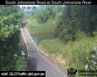
Flood cameraSouth Johnstone - South Johnstone Road At South Johnstone RiverQLD
Show map of South Johnstone - South Johnstone Road At South Johnstone Riverabout 20 KB · loads only when opened▾ Hide map
Map preview · about 20 KB · © OpenStreetMap
Camera: Flood camera location; does not indicate flooding Direction: East Location: South Johnstone Information: New images available every 30 minutes. Images between 6pm and 6am may be of reduced…
-17.5991, 145.9978
Details OpenStreetMap Source (State of Queensland (Department of Transport and Main Roads))
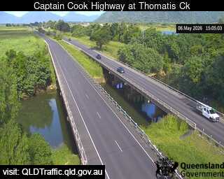
Flood cameraYorkeys Knob - Captain Cook Highway At Thomatis CreekYorkey's Knob · QLD
Show map of Yorkeys Knob - Captain Cook Highway At Thomatis Creekabout 20 KB · loads only when opened▾ Hide map
Map preview · about 20 KB · © OpenStreetMap
Camera: Flood camera location; does not indicate flooding Direction: North Location: Yorkey's Knob Information: New images available every 30 minutes between 6am and 6pm. View camera image
-16.8507, 145.7167
Details OpenStreetMap Source (State of Queensland (Department of Transport and Main Roads))
Flood cameraYandina - Yandina Bli Bli Road At Caboolture CreekQLD
Show map of Yandina - Yandina Bli Bli Road At Caboolture Creekabout 20 KB · loads only when opened▾ Hide map
Map preview · about 20 KB · © OpenStreetMap
Camera: Flood camera location; does not indicate flooding Direction: South Location: Yandina Information: New images available every 30 minutes between 6am and 6pm. Image supplied by: Department of…
-26.5748, 152.9749
Details OpenStreetMap Source (Department of Transport and Main Roads)
Flood cameraBeachmere - Caboolture Beachmere Road At King John Creek - Southwest - 4510QLD
Show map of Beachmere - Caboolture Beachmere Road At King John Creek - Southwest - 4510about 20 KB · loads only when opened▾ Hide map
Map preview · about 20 KB · © OpenStreetMap
Camera: Flood camera location; does not indicate flooding Direction: SouthWest Location: Beachmere Information: New images available every 30 minutes between 6am and 6pm. Image supplied by:…
-27.1143, 153.0333
Details OpenStreetMap Source (Department of Transport and Main Roads)
Flood cameraBli Bli - Maroochydore Noosa Road At Muller Park Road IntersectionQLD
Show map of Bli Bli - Maroochydore Noosa Road At Muller Park Road Intersectionabout 20 KB · loads only when opened▾ Hide map
Map preview · about 20 KB · © OpenStreetMap
Camera: Flood camera location; does not indicate flooding Direction: East Location: Bli Bli Information: New images available every 30 minutes between 6am and 6pm. Image supplied by: Department of…
-26.6225, 153.0483
Details OpenStreetMap Source (Department of Transport and Main Roads)
Flood cameraBurpengary - Burpengary Service Road/ Old Gympie Road At Burpengary CreekQLD
Show map of Burpengary - Burpengary Service Road/ Old Gympie Road At Burpengary Creekabout 20 KB · loads only when opened▾ Hide map
Map preview · about 20 KB · © OpenStreetMap
Camera: Flood camera location; does not indicate flooding Direction: North Location: Burpengary Information: New images available every 30 minutes between 6am and 6pm. Image supplied by: Department…
-27.1524, 152.9769
Details OpenStreetMap Source (Department of Transport and Main Roads)
Flood cameraBurpengary - Burpengary Service Road/ Old Gympie Road At Little Burpengary CreekQLD
Show map of Burpengary - Burpengary Service Road/ Old Gympie Road At Little Burpengary Creekabout 20 KB · loads only when opened▾ Hide map
Map preview · about 20 KB · © OpenStreetMap
Camera: Flood camera location; does not indicate flooding Direction: North Location: Burpengary Information: New images available every 30 minutes between 6am and 6pm Image supplied by: Department of…
-27.1744, 152.9813
Details OpenStreetMap Source (Department of Transport and Main Roads)
Flood cameraCaloundra West- Caloundra Road At Industrial AvenueQLD
Show map of Caloundra West- Caloundra Road At Industrial Avenueabout 20 KB · loads only when opened▾ Hide map
Map preview · about 20 KB · © OpenStreetMap
Camera: Flood camera location; does not indicate flooding Direction: South Location: Caloundra West Information: New images are available every 30 minutes, between 6am and 6pm. Image supplied by:…
-26.7989, 153.1149
Details OpenStreetMap Source (Department of Transport and Main Roads)
Flood cameraConondale - Maleny-Kenilworth Road At Minchenton GullyQLD
Show map of Conondale - Maleny-Kenilworth Road At Minchenton Gullyabout 20 KB · loads only when opened▾ Hide map
Map preview · about 20 KB · © OpenStreetMap
Camera: Flood camera location; does not indicate flooding Direction: NorthEast Location: Conondale Information: New images available every 30 minutes between 6am and 6pm. Image supplied by:…
-26.7325, 152.7541
Details OpenStreetMap Source (Department of Transport and Main Roads)