Bundaberg · council area
Needs action
No Emergency Warnings or Watch and Act alerts right now.
Show map of Bundabergabout 20 KB · loads only when opened▾ Hide map
Map preview · about 20 KB · © OpenStreetMap
Current items by layer
- Flood6No warnings
- Roads4No warnings+22 planned or other
- Power outages1No warnings+9 planned or other
- Other9No warnings
Some flood sources for Queensland aren't on this page yet, so this list may be incomplete
Some other sources for Queensland aren't on this page yet, so this list may be incomplete
Nothing current for Fire, Burn areas or Earthquakes.
Live weather data for Queensland isn't available here yet
Live water supply data for Queensland isn't available here yet
Live algal blooms data for Queensland isn't available here yet
Live dams data for Queensland isn't available here yet
Live sharksmart data for Queensland isn't available here yet
Roads 26
Level: All levels · Emergency Warning · Watch and Act · Advice
Road damageHazard — Bruce Highway — Booyal / Isis CentralBooyal / Isis Central · QLD ·
Show map of Hazard — Bruce Highway — Booyal / Isis Centralabout 20 KB · loads only when opened▾ Hide map
Map preview · about 20 KB · © OpenStreetMap
Event: Hazard Type: Road damage Cause: Rough surface Road: Bruce Highway Location: Booyal / Isis Central Description: Between Kevin Livingston Drive and Booyal Dallarnil Road Impact: All lanes…
Updated 28 Oct, 8:18 pm AEST · -25.2120, 152.1146
Details OpenStreetMap Source (Department of Transport and Main Roads)
Road damageHazard — Bruce Highway — Apple Tree CreekApple Tree Creek · QLD ·
Show map of Hazard — Bruce Highway — Apple Tree Creekabout 20 KB · loads only when opened▾ Hide map
Map preview · about 20 KB · © OpenStreetMap
Event: Hazard Type: Road damage Cause: Rough surface Road: Bruce Highway Location: Apple Tree Creek Description: In the vicinity of Apple Tree Creek Cemetery Impact: All lanes affected Direction: All…
Updated 28 Oct, 8:18 pm AEST · -25.2250, 152.2400
Details OpenStreetMap Source (Department of Transport and Main Roads)
Scheduled roadworkRoadworks — Welch Street — Elliott HeadsElliott Heads · QLD ·
Show map of Roadworks — Welch Street — Elliott Headsabout 20 KB · loads only when opened▾ Hide map
Map preview · about 20 KB · © OpenStreetMap
Event: Roadworks Type: Planned roadworks Road: Welch Street Location: Elliott Heads Description: Closure due to development works. Impact: Road closed to all traffic Direction: Both directions…
Updated 28 Oct, 7:44 am AEST · -24.9088, 152.4883
Details OpenStreetMap Source (Bundaberg Regional Council Disaster Management)
Scheduled roadworkRoadworks — Bruce Highway — Isis RiverIsis River · QLD ·
Show map of Roadworks — Bruce Highway — Isis Riverabout 20 KB · loads only when opened▾ Hide map
Map preview · about 20 KB · © OpenStreetMap
Event: Roadworks Type: Planned roadworks Road: Bruce Highway Location: Isis River Impact: All lanes affected Direction: Both directions Delays: Delays expected (during active hours) Advice: Observe…
Updated 26 Oct, 9:20 pm AEST · -25.2553, 152.3644
Details OpenStreetMap Source (Department of Transport and Main Roads)
Scheduled roadworkRoadworks — Bruce Highway — KolongaKolonga · QLD ·
Show map of Roadworks — Bruce Highway — Kolongaabout 20 KB · loads only when opened▾ Hide map
Map preview · about 20 KB · © OpenStreetMap
Event: Roadworks Type: Planned roadworks Road: Bruce Highway Location: Kolonga Impact: All lanes affected Direction: Both directions Delays: Delays expected (during active hours) Advice: Observe…
Updated 25 Oct, 6:44 pm AEST · -24.7424, 151.7149
Details OpenStreetMap Source (Department of Transport and Main Roads)
Scheduled roadworkRoadworks — Bruce Highway — KolongaKolonga · QLD ·
Show map of Roadworks — Bruce Highway — Kolongaabout 20 KB · loads only when opened▾ Hide map
Map preview · about 20 KB · © OpenStreetMap
Event: Roadworks Type: Planned roadworks Road: Bruce Highway Location: Kolonga Description: Fischers Creek Culvert, Bruce Highway Kolonga. Speed reduction, culvert works. Direction: Both directions…
Updated 25 Oct, 6:44 pm AEST · -24.7339, 151.7093
Details OpenStreetMap Source (Department of Transport and Main Roads)
Scheduled roadworkRoadworks — Maryborough Street / Burrum Street — Bundaberg South / Bundaberg WestBundaberg South / Bundaberg West · QLD ·
Show map of Roadworks — Maryborough Street / Burrum Street — Bundaberg South / Bundaberg Westabout 20 KB · loads only when opened▾ Hide map
Map preview · about 20 KB · © OpenStreetMap
Event: Roadworks Type: Planned roadworks Road: Maryborough Street / Burrum Street Location: Bundaberg South / Bundaberg West Description: Boreham Street, Bundaberg Central - Pathway and Accessibility…
Updated 21 Oct, 12:10 pm AEST · -24.8742, 152.3479
Details OpenStreetMap Source (Bundaberg Regional Council Disaster Management)
Scheduled roadworkRoadworks — Bruce Highway — KolongaKolonga · QLD ·
Show map of Roadworks — Bruce Highway — Kolongaabout 20 KB · loads only when opened▾ Hide map
Map preview · about 20 KB · © OpenStreetMap
Event: Roadworks Type: Planned roadworks Road: Bruce Highway Location: Kolonga Description: Planned roadworks for Bruce Highway upgrade at Kalpowar, including temporary HVRA closure. Impact: All…
Updated 19 Oct, 4:43 pm AEST · -24.8252, 151.7066
Details OpenStreetMap Source (Department of Transport and Main Roads)
Bridge or culvert damagedHazard — Mclennan Drive / Zillmann Road — WallavilleWallaville · QLD ·
Show map of Hazard — Mclennan Drive / Zillmann Road — Wallavilleabout 20 KB · loads only when opened▾ Hide map
Map preview · about 20 KB · © OpenStreetMap
Event: Hazard Type: Bridge or culvert damaged Road: McLennan Drive / Zillmann Road Location: Wallaville Description: REDUCED LOAD LIMIT - Max 35T - McLennan Drive Impact: Subject to a 25 tonne GVM…
Updated 9 Oct, 2:46 pm AEST · -25.0849, 151.9939
Details OpenStreetMap Source (Bundaberg Regional Council Disaster Management)
Scheduled roadworkRoadworks — Wises Road / Goodwood Road — AllowayAlloway · QLD ·
Show map of Roadworks — Wises Road / Goodwood Road — Allowayabout 20 KB · loads only when opened▾ Hide map
Map preview · about 20 KB · © OpenStreetMap
Event: Roadworks Type: Planned roadworks Road: Wises Road / Goodwood Road Location: Alloway Description: Pavement Repair Works, Wises Road, Alloway Impact: Lane or lanes reduced Direction: Both…
Updated 7 Oct, 1:32 pm AEST · -24.9541, 152.3752
Details OpenStreetMap Source (Bundaberg Regional Council Disaster Management)
Scheduled roadworkRoadworks — South Bucca Road — BuccaBucca · QLD ·
Show map of Roadworks — South Bucca Road — Buccaabout 20 KB · loads only when opened▾ Hide map
Map preview · about 20 KB · © OpenStreetMap
Event: Roadworks Type: Planned roadworks Road: South Bucca Road Location: Bucca Description: ROAD CLOSED - South Bucca Road - Diversion via Bucca Road Impact: Road closed to all traffic Direction:…
Updated 6 Oct, 8:20 am AEST · -24.8953, 152.0821
Details OpenStreetMap Source (Bundaberg Regional Council Disaster Management)
Scheduled roadworkRoadworks — Isis Highway (Childers Road) — Elliott / South BingeraElliott / South Bingera · QLD ·
Show map of Roadworks — Isis Highway (Childers Road) — Elliott / South Bingeraabout 20 KB · loads only when opened▾ Hide map
Map preview · about 20 KB · © OpenStreetMap
Event: Roadworks Type: Planned roadworks Road: Isis Highway (Childers Road) Location: Elliott / South Bingera Impact: Lane or lanes reduced Direction: Both directions Delays: Delays expected (during…
Updated 29 Sept, 8:37 am AEST · -24.9979, 152.2079
Details OpenStreetMap Source (Department of Transport and Main Roads)
Scheduled roadworkRoadworks — Poinciana Drive — Innes ParkInnes Park · QLD ·
Show map of Roadworks — Poinciana Drive — Innes Parkabout 20 KB · loads only when opened▾ Hide map
Map preview · about 20 KB · © OpenStreetMap
Event: Roadworks Type: Planned roadworks Road: Poinciana Drive Location: Innes Park Description: Road Reconstruction Upgrade Works Impact: Road closed to through traffic Direction: Both directions…
Updated 18 Sept, 5:59 am AEST · -24.8539, 152.4708
Details OpenStreetMap Source (Bundaberg Regional Council Disaster Management)
Scheduled roadworkRoadworks — Gilgai Road / Wallaville Goondoon Road — DelanDelan · QLD ·
Show map of Roadworks — Gilgai Road / Wallaville Goondoon Road — Delanabout 20 KB · loads only when opened▾ Hide map
Map preview · about 20 KB · © OpenStreetMap
Event: Roadworks Type: Planned roadworks Road: Gilgai Road / Wallaville Goondoon Road Location: Delan Description: DETOUR IN PLACE - Wallaville Goondoon Road. Delan is closed - works to be completed…
Updated 14 Sept, 6:58 am AEST · -25.0335, 152.0381
Details OpenStreetMap Source (Bundaberg Regional Council Disaster Management)
Bridge or culvert damagedHazard — Walla Road — Saint AgnesSaint Agnes · QLD ·
Show map of Hazard — Walla Road — Saint Agnesabout 20 KB · loads only when opened▾ Hide map
Map preview · about 20 KB · © OpenStreetMap
Event: Hazard Type: Bridge or culvert damaged Road: Walla Road Location: Saint Agnes Description: REDUCED LOAD LIMIT Max. 15T - St Agnes Bridge - Walla Road Impact: Subject to a 15 tonne GVM limit…
Updated 14 Sept, 6:48 am AEST · -25.1344, 151.9735
Details OpenStreetMap Source (Bundaberg Regional Council Disaster Management)
Scheduled roadworkRoadworks — Targo Street / George Street — Bundaberg CentralBundaberg Central · QLD ·
Show map of Roadworks — Targo Street / George Street — Bundaberg Centralabout 20 KB · loads only when opened▾ Hide map
Map preview · about 20 KB · © OpenStreetMap
Event: Roadworks Type: Planned roadworks Road: Targo Street / George Street Location: Bundaberg Central Description: Road Closure - George St & Targo St Culvert & Intersection Upgrade - Construction…
Updated 13 Sept, 12:29 pm AEST · -24.8713, 152.3526
Details OpenStreetMap Source (Bundaberg Regional Council Disaster Management)
Scheduled roadworkRoadworks — Billabong Way — BuccaBucca · QLD ·
Show map of Roadworks — Billabong Way — Buccaabout 20 KB · loads only when opened▾ Hide map
Map preview · about 20 KB · © OpenStreetMap
Event: Roadworks Type: Planned roadworks Road: Billabong Way Location: Bucca Description: Billabong Way, Bucca - Drainage Improvements Impact: Lane or lanes reduced Direction: Both directions Delays:…
Updated 1 Sept, 10:32 am AEST · -24.8678, 152.1458
Details OpenStreetMap Source (Bundaberg Regional Council Disaster Management)
Scheduled roadworkRoadworks — Maryborough Street — Bundaberg SouthBundaberg South · QLD ·
Show map of Roadworks — Maryborough Street — Bundaberg Southabout 20 KB · loads only when opened▾ Hide map
Map preview · about 20 KB · © OpenStreetMap
Event: Roadworks Type: Planned roadworks Road: Maryborough Street Location: Bundaberg South Description: Maryborough Street, Bundaberg Central - Pathway and Accessibility Improvements Impact: Lane or…
Updated 1 Sept, 7:22 am AEST · -24.8754, 152.3495
Details OpenStreetMap Source (Bundaberg Regional Council Disaster Management)
Scheduled roadworkRoadworks — Que Hee Street / Totten Street / Steindl Street / Scotland Street — Bundaberg East / KepnockBundaberg East / Kepnock · QLD ·
Show map of Roadworks — Que Hee Street / Totten Street / Steindl Street / Scotland Street — Bundaberg East / Kepnockabout 20 KB · loads only when opened▾ Hide map
Map preview · about 20 KB · © OpenStreetMap
Event: Roadworks Type: Planned roadworks Road: Que Hee Street / Totten Street / Steindl Street / Scotland Street Location: Bundaberg East / Kepnock Description: ROAD OPEN - 30KM SPEED LIMIT - 9 TONNE…
Updated 14 July, 8:00 am AEST · -24.8659, 152.3734
Details OpenStreetMap Source (Bundaberg Regional Council Disaster Management)
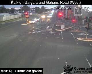
Traffic cameraKalkie - Bargara Road & Gahans Road - WestQLD
Show map of Kalkie - Bargara Road & Gahans Road - Westabout 20 KB · loads only when opened▾ Hide map
Map preview · about 20 KB · © OpenStreetMap
Camera: Traffic camera location Direction: SouthWest Location: Kalkie View camera image
-24.8520, 152.3838
Details OpenStreetMap Source (State of Queensland (Department of Transport and Main Roads))
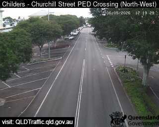
Traffic cameraChilders - Churchill Street Pedestrian Crossing - NorthwestQLD
Show map of Childers - Churchill Street Pedestrian Crossing - Northwestabout 20 KB · loads only when opened▾ Hide map
Map preview · about 20 KB · © OpenStreetMap
Camera: Traffic camera location Direction: SouthWest Location: Childers View camera image
-25.2363, 152.2789
Details OpenStreetMap Source (State of Queensland (Department of Transport and Main Roads))
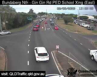
Traffic cameraBundaberg North - Gin Gin Road School Pedestrian Crossing - EastQLD
Show map of Bundaberg North - Gin Gin Road School Pedestrian Crossing - Eastabout 20 KB · loads only when opened▾ Hide map
Map preview · about 20 KB · © OpenStreetMap
Camera: Traffic camera location Direction: SouthEast Location: Bundaberg North View camera image
-24.8510, 152.3399
Details OpenStreetMap Source (State of Queensland (Department of Transport and Main Roads))
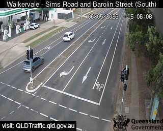
Traffic cameraWalkervale - Sims Road & Barolin Street - SouthQLD
Show map of Walkervale - Sims Road & Barolin Street - Southabout 20 KB · loads only when opened▾ Hide map
Map preview · about 20 KB · © OpenStreetMap
Camera: Traffic camera location Direction: SouthEast Location: Walkervale View camera image
-24.8890, 152.3582
Details OpenStreetMap Source (State of Queensland (Department of Transport and Main Roads))
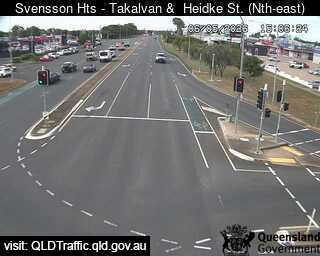
Traffic cameraSvensson Heights - Takalvan Street & Heidke Street - NortheastQLD
Show map of Svensson Heights - Takalvan Street & Heidke Street - Northeastabout 20 KB · loads only when opened▾ Hide map
Map preview · about 20 KB · © OpenStreetMap
Camera: Traffic camera location Direction: NorthEast Location: Svensson Heights View camera image
-24.8879, 152.3210
Details OpenStreetMap Source (State of Queensland (Department of Transport and Main Roads))
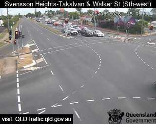
Traffic cameraSvensson Heights - Takalvan Street & Walker Street - SouthwestQLD
Show map of Svensson Heights - Takalvan Street & Walker Street - Southwestabout 20 KB · loads only when opened▾ Hide map
Map preview · about 20 KB · © OpenStreetMap
Camera: Traffic camera location Direction: SouthWest Location: Svensson Heights View camera image
-24.8773, 152.3298
Details OpenStreetMap Source (State of Queensland (Department of Transport and Main Roads))
Also in
Postcodes: 4673, 4670, 4660, 4671, 4630
Suburbs: Bargara, Bundaberg North, Avenell Heights, Avoca (Qld), Branyan, Kepnock